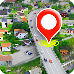
Satellite View
Maps & Navigation- Category Maps & Navigation
- Size 59.4 MB
- Requirements Android 0 and up
- Downloads 610,000,000+
- Package Name com.earthglobemap.livesatellite.gps
- Content Rating Everyone
About Satellite View Feature – Exploring the World from Above
Satellite View is a powerful mapping application that delivers high-resolution satellite imagery and aerial photography of the entire globe directly to your mobile device. It transforms your phone into a window to the world, allowing you to explore distant landscapes, familiar neighborhoods, and iconic landmarks from a unique overhead perspective. The app seamlessly integrates detailed map data with crisp, up-to-date satellite photos, providing a comprehensive tool for visualization, planning, and discovery. Its intuitive interface ensures that navigating this vast repository of visual data is both simple and engaging for users of all levels.
Chapter 1: Function
Satellite View app specializes in rendering high-definition satellite imagery onto an interactive global map. Its core function allows users to zoom, pan, and rotate the view to explore any location on Earth. The app provides multiple viewing modes, including a pure satellite layer, a hybrid map with labels overlaid on imagery, and standard street maps. Key features include the ability to search for specific addresses or coordinates, save favorite locations for quick access, and measure distances between points directly on the map. The technology behind the app continuously streams high-resolution tiles, ensuring that the visuals are sharp even when zoomed in closely. It also offers 3D terrain modeling in many regions, giving a realistic sense of topography and elevation. The performance is optimized for mobile devices, balancing visual detail with smooth navigation and efficient data usage.
Chapter 2: Value
The primary value of Satellite View lies in its ability to make detailed, real-world visual information accessible and actionable. For professionals, it serves as a crucial tool for site analysis, environmental monitoring, urban planning, and logistics, providing a context that traditional maps cannot offer. For educators and students, it is an invaluable resource for geography, geology, and social studies, making abstract concepts tangible by visualizing them on a real-world canvas. For travelers and adventurers, it offers unparalleled trip planning capabilities, allowing them to scout trails, understand terrain, and preview destinations before arrival. The app demystifies the world around us, fostering a greater understanding of global geography, human settlement patterns, and natural landscapes. Its key advantages include the sheer breadth of its image database, the clarity and recency of its visuals, and the simplicity of its user interface. Unlike static maps, Satellite View provides a dynamic, explorable model of the planet, empowering users to satisfy their curiosity, enhance their work, and make more informed decisions based on a comprehensive visual understanding of any place on Earth.
Chapter 3: Scenarios
Satellite View caters to a diverse range of users across various everyday scenarios. Real estate agents frequently use it to show clients the layout of a property, the surrounding neighborhood, and proximity to amenities, providing context that photos alone cannot. Hikers, cyclists, and outdoor enthusiasts rely on the app to pre-visualize trails, assess the difficulty of terrain, and identify potential landmarks or obstacles in remote areas. Event planners and travelers use it to scout venues and get a literal overview of a new city, understanding the spatial relationship between airports, hotels, and attractions. Homeowners utilize the app for planning garden layouts, solar panel installations, or property extensions by accurately viewing their land from above. Journalists and researchers employ it to verify locations and understand the geographical context of news events. In educational scenarios, teachers use it for virtual field trips, making lessons on volcanoes, river deltas, or ancient civilizations more immersive. Even in daily life, a user might pull up the app to settle a bet about the shape of a local park or to preview the parking situation at a new restaurant.